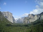
Pacific Crest Trail’s magnificent 2,650-mile journey through California, Oregon, and Washington presents ever-changing trail conditions that demand careful preparation. Alpine passes create diverse challenges across scorching desert floors and snow-packed mountain sections, requiring hikers to adapt their strategies constantly.
Approximately 70% of PCT thru-hikers abandon their journey when unexpected snowpack levels and trail obstacles exceed their preparedness.
Trail closures regularly impact route planning across dramatically different ecosystems along the path.
Water sources transform ordinary hiking segments into logistical puzzles requiring specialized equipment and navigation skills.
Desert sections present several common challenges:.
- Seasonal water source availability and caching strategies
- Wildfire detours and sudden trail closures
- Snow-covered mountain passes requiring route-finding expertise
- Weather-related hazards and exposure risks
Contents
- 1 Seasonal Variations Transform the PCT Experience
- 2 When to Navigate Snowpack Levels Safely
- 3 Current Trail Closures and Alternatives
- 4 Finding Reliable Water Sources Ahead
- 5 Preparing for Desert Sections Challenges
- 6 How Stream Crossings Impact Hikers
- 7 Dealing with Altitude Sickness Symptoms
- 8 Essential Gear Recommendations for Conditions
Seasonal Variations Transform the PCT Experience
Snowpack levels dictate the hiking calendar across all PCT regions, creating distinct optimal windows for each section. Desert sections typically become most manageable between April and May, before dangerous heat advisories become common. Water sources during late spring and summer months grow critically scarce, necessitating strategic planning and possible exposed ridges detours.
Regional Timing Windows
High Sierra presents unique trail obstacles with snow bridges often blocking passage until mid-June or later depending on winter accumulation. Cascades terrain generally opens for hikers from July through September when most alpine passes clear of deep snow. Creek fords present significant shoulder season challenges including:
- Desert Section: April-May (before extreme heat)
- Sierra Nevada: June-September (after major snowmelt)
- Washington Section: July-September (avoiding early fall snow)
- Creek Fords: Most dangerous during peak snowmelt periods
Path hazards vary dramatically from year to year, requiring hikers to maintain flexibility in their itineraries. Mosquito season typically peaks shortly after snowmelt, making protective gear recommendations essential for comfortable hiking through meadow sections. Permit requirements remain consistent regardless of seasonal variations, though weather updates may necessitate schedule adjustments.

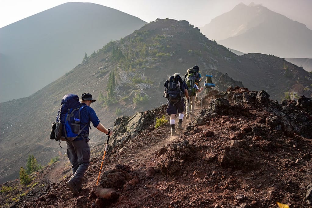
Snowpack levels determine passage feasibility through high-elevation sections of the Pacific Crest Trail. Different mountain ranges throughout the 2,650-mile journey from Mexico to Canada present unique snow conditions that require careful assessment.
Sierra Nevada passes typically maintain deep snow well into June, creating significant navigation challenges for early-season hikers attempting to cross these formidable terrain features.
Practical Assessment Techniques
Alpine passes require practical assessment techniques before any snow crossing attempt.
The pole penetration method provides reliable feedback about snow stability—if your trekking pole sinks completely through the snowpack levels, conditions may be too soft for safe passage.
Experienced mountaineers recommend crossing snow-covered terrain before 10 am when postholing risks are minimized and snow bridges retain maximum strength.
- Morning advantage: Early crossings utilize overnight freeze that creates a supportive crust
- Afternoon hazards: Sun exposure weakens snow structures throughout the day
- Weather updates: Check forecasts daily as temperatures affect snow consistency
Gear Adaptations for Snow Conditions
Microspikes provide sufficient traction for moderate slopes based on current hiking reports from thruhikers navigating similar conditions. Steeper alpine passes may necessitate crampons for secure footing when traversing icy sections that present significant obstacles to forward progress. Footwear considerations become critical as snow bridges weaken under afternoon sun exposure, requiring waterproof boots with adequate ankle support.
Trail closures might affect your snow crossing strategy, so always verify current conditions before committing to high-elevation routes. PCT trail conditions demand adaptability—carrying lightweight snow travel gear until you’ve cleared the final high-elevation section allows for safe navigation while minimizing unnecessary pack weight.
Current Trail Closures and Alternatives
Wildfire detours represent the most unpredictable disruptions to continuous hiking along the Pacific Crest Trail. Natural and human-caused events reshape the PCT annually, forcing hikers to adapt their journey through affected trail sections. Pacific Crest trail status updates reflect both planned maintenance closures and emergency restrictions that demand flexible itinerary adjustments throughout the hiking season.
Decision Framework for Reroutes
Trail closures follow a decision hierarchy that prioritizes hiker safety above all considerations when evaluating potential alternate routes. Distance and difficulty become secondary factors after ensuring path hazards are minimized through proper route selection. Seasonal variations affect which detours remain viable, particularly in areas where snowpack levels might block high-elevation bypass options.
- Primary considerations: Safety, feasibility, and official recommendations
- Secondary factors: Distance added, elevation change, and technical difficulty
- Logistical impacts: Access to water sources and resupply points
Resource Planning Around Closures
Alternate routes often impact resource planning, potentially extending distances between resupply points by 20-50 miles through remote stretches of trail. Hikers should incorporate buffer supplies when navigating around closures, particularly in sections with limited water access or where water caches might be unreliable due to increased hiker traffic on detours.
Hiker reports demonstrate that successful navigation requires multiple information sources for trail conditions verification. The official PCTA website provides authoritative updates about current closures, while Forest Service alerts and trail angel networks offer complementary regional insights about specific junction markers and trail sections. Information currency becomes essential during shoulder season when conditions change rapidly due to weather updates or new management decisions.
| Snow Crossing Recommendations | Trail Closure Management |
|---|---|
| Cross snow-covered terrain before 10 am when snow is most stable | Prioritize safety over distance when selecting alternate routes |
| Use microspikes for moderate slopes, crampons for steeper sections | Carry 20-50 additional miles of supplies when navigating detours |
| Sierra Nevada passes typically maintain deep snow through June | Consult PCTA website, Forest Service alerts, and trail angel networks for current conditions |
Finding Reliable Water Sources Ahead
Water sources throughout the Pacific Crest Trail create a dynamic hydrological puzzle requiring meticulous advance planning. Seasonal variations transform water availability dramatically, forcing hikers to develop section-specific water strategies.
Desert stretches present exceptional water management challenges where reliable springs might exist 20-30 miles apart.
Trail angels maintain water caches throughout popular PCT sections, though experienced hikers never depend solely on these generous trail magic offerings.
Hiker reports from fellow travelers provide current intelligence about water conditions that could save countless miles of unnecessary detour.
Section-Specific Water Planning
Snowpack levels influence high-elevation water availability throughout the hiking season, making research before each section mandatory. Northern terminus areas typically offer abundant water while southern regions demand precise water point mapping.
Water caches appear sporadically along exposed ridges where natural sources remain scarce, yet hikers must always carry capacity for unexpected dry stretches. Mileage markers between reliable sources should determine your carried water volume, with desert sections often requiring 6+ liters per person.
PCT Water Wisdom:
Never pass a reliable water source without evaluating your next opportunity!
Digital resources equip modern PCT hikers with real-time water intelligence:.
- Guthook/FarOut app – Crowdsourced water reports with GPS waypoints
- PCT Water Report – Regularly updated spreadsheets of source conditions
- Local ranger stations – Official information about seasonal creek fords and spring status
- Facebook trail groups – Current observations from hikers in your vicinity
Water Quality Assessment Techniques
Stream crossings provide abundant water but require filtration due to potential upstream contamination. Water quality varies significantly between natural sources, with alpine streams generally offering higher purity than lowland ponds. Flash flood warnings may indicate recent water source contamination, necessitating additional treatment methods beyond standard filtration. Footpath integrity near water sources often signals usage frequency, with heavily trampled approaches suggesting popular, reliable options.
Evaluate source types based on these quality factors:.
- Clear, flowing mountain streams (highest quality)
- Springs emerging directly from ground
- Seasonal creeks (check recent flow reports)
- Lakes and ponds (filter for microorganisms)
- Cattle tanks and developed sources (potential contamination)
Preparing for Desert Sections Challenges
Exposed ridges dominate southern PCT segments, creating extreme environmental conditions beyond mere water scarcity. Desert sections present a multifaceted challenge including dramatic temperature swings, relentless sun exposure, and minimal natural shelter. Trail closures occasionally restrict passage through particularly hazardous desert areas during extreme heat events. Thruhiking success requires adapting both schedule and equipment specifically for desert efficiency, with many hikers adopting completely different daily rhythms.
Desert Timing Strategies
Weather updates should guide your desert section timing, with many hikers purposely avoiding peak summer heat. Experienced hikers implement siesta schedules through desert terrain, hiking during cooler morning hours before seeking shade during intense midday heat. Path hazards increase significantly during afternoon desert hiking when heat exhaustion risks peak alongside rattlesnake warnings due to increased reptile activity. Campsite availability near reliable water determines many hikers’ daily mileage targets through water-scarce regions.
Desert Rhythm:
Rise early, hike dawn to 11am, rest 11am-4pm, resume hiking until dark
Tactical gear modifications maximize desert hiking efficiency:.
- Clothing system: Lightweight, loose-fitting garments with full UPF protection
- Portable shade: Hiking umbrellas that create personal shade structures
- Cooling tools: Bandanas for evaporative neck cooling when dampened
- Hydration capacity: Additional water containers for 30+ mile waterless stretches
- Electrolyte supplements: Preventing hyponatremia during excessive sweating
Heat advisories must govern decision-making through desert terrain, as temperatures transform manageable trail sections into dangerous environments within hours. Alternate routes sometimes provide emergency options when conditions exceed safety thresholds. Resupply points throughout desert sections enable hikers to minimize carried weight while maximizing water capacity for the specific upcoming stretch.
PCT Water Management
- Desert sections of the PCT can have water sources 20-30 miles apart, requiring hikers to carry 6+ liters per person
- Digital resources like Guthook/FarOut app and PCT Water Report provide real-time information about water conditions
- Experienced hikers adopt siesta schedules in desert terrain, hiking during cooler morning hours and resting during midday heat
- Water quality varies significantly between sources, with alpine streams generally offering higher purity than lowland ponds
How Stream Crossings Impact Hikers
Stream crossings present significant physical and mental challenges along the Pacific Crest Trail. Snowpack levels influence water volume and crossing difficulty throughout the hiking season.
Assessing Crossing Safety
Alpine passes create natural collection points for snowmelt, making stream crossings particularly hazardous during peak runoff.
Trail closures occasionally result from impassable water bodies.
Hikers should evaluate:
• Water depth and current speed
• Streambed composition and stability
• Availability of crossing aids (logs, rocks)
• Potential downstream hazards
Water sources vary dramatically throughout the trail, requiring different crossing techniques. Desert sections typically offer easier crossings while high mountain streams demand greater caution and skill.
Psychological Challenges
Wildfire detours sometimes force hikers to encounter unfamiliar water crossings not documented in guides. Mental preparation becomes equally important as physical technique. Altitude sickness can compound anxiety at high-elevation crossings.
Stream crossings frequently represent psychological barriers for many hikers.
The combination of cold water, uncertain footing, and potential danger creates significant stress.
Trail angels occasionally provide guidance at notorious crossing points during peak season.
Technique Modifications
Bear canisters can serve as waterproof storage during challenging crossings.
Different water bodies require specific approaches:
Shallow, slow streams: Direct crossing with hiking poles for stability.
Deep, moderate current: Group crossing with mutual support.
Fast-flowing waters: Seeking alternative crossing points
Avalanche risk assessment skills transfer well to evaluating stream crossing dangers.
Patience and willingness to adjust plans remain essential when facing difficult crossings.
Sun exposure during extended scouting efforts for crossing points requires protective measures. Experienced hikers develop personalized crossing protocols based on their comfort level and physical capabilities.
Dealing with Altitude Sickness Symptoms
Alpine passes along the Pacific Crest Trail can trigger altitude-related health issues for unprepared hikers. Recognizing early warning signs helps prevent dangerous situations.
Your body requires time to adjust to decreased oxygen levels above 8,000 feet.
Pushing too hard too fast invites altitude sickness.
Snowpack levels impact hiking pace through high-elevation sections, affecting acclimatization timing.
Common early symptoms include:
• Headache that worsens at night
• Loss of appetite and nausea
• Fatigue beyond normal exertion levels
• Dizziness and sleep disturbances
Trail closures sometimes force rapid elevation changes that increase sickness risk. Water sources become increasingly important as proper hydration helps prevent symptoms.
Prevention Strategies During Acclimatization
Desert sections contrast sharply with high mountain terrain, making the body’s adjustment more difficult. Effective prevention includes:
Gradual ascent (gain no more than 1,000 feet of sleeping elevation daily).
Hydrate consistently throughout the day.
Consider climb high, sleep low approach when possible
Avoid alcohol and sleeping medications
Wildfire detours can unexpectedly alter elevation profiles.
Flexibility with your hiking schedule allows proper adaptation to higher elevations.
Severe symptoms demand immediate descent. No spectacular view justifies risking high altitude cerebral or pulmonary edema.
Altitude sickness represents one of the most preventable yet dangerous conditions on trail.
Stream crossings become more hazardous when judgment is impaired by altitude effects.
Hikers previously affected should exercise additional caution on subsequent high-elevation sections.
PCT Challenges
- Snowpack levels directly influence water volume and crossing difficulty throughout the hiking season
- Altitude sickness commonly begins with headaches, nausea, fatigue and dizziness above 8,000 feet
- Experts recommend gaining no more than 1,000 feet of sleeping elevation daily for proper acclimatization
- Mental preparation is equally important as physical technique when facing challenging stream crossings
Essential Gear Recommendations for Conditions
Alpine passes demand strategic equipment choices that balance weight, functionality, and protection across diverse environments. Versatile hiking gear serves as your first line of defense against unpredictable elements encountered throughout your journey.
Experienced thruhikers recommend a modular approach that adapts to seasonal variations without requiring complete gear overhauls.
Desert Section Essentials
Snowpack levels influence early season gear needs, but desert sections require ultralight backpacking principles—prioritize sun protection with a wide-brimmed hat, UV-rated clothing, and lightweight gaiters to prevent sand infiltration.
Water sources become scarce, so capacity should exceed 6 liters when navigating between distant water caches.
The PCT spans 2,650 miles from Mexico to Canada, exposing hikers to temperature swings of 70°F within single days.
Mountain Passage Gear
Trail closures may occur in high elevation sections where snow persists into July. Your gear list should include microspikes and trekking poles as non-negotiable safety equipment.
The Sierra Nevada and Cascades terrain present navigation challenges requiring compass and detailed maps even when following established footpaths.
Weight-to-Utility Balance
Water caches help during dry stretches, but never rely exclusively on them. The ideal pack for thruhiking balances these considerations against utility:
- Shelter: 2-3 pounds maximum with storm-worthiness for high elevations
- Sleep system: Temperature rating 15-20°F for early-season Sierra crossings
- Water filtration: Redundant systems weighing under 5 ounces combined
- Layering system: Adaptable pieces that manage moisture efficiently
Hiker reports confirm that trail conditions vary dramatically by season, elevation, and weather patterns. Your equipment selections should reflect this variability while maintaining reasonable pack weight. Recent wildfire detours have changed traditional resupply strategies, requiring flexible planning and occasional gear adjustments mid-journey.
PCT Hiking Gear
- Temperature variations on the PCT can reach 70°F within a single day, requiring adaptable clothing layers
- Water capacity should exceed 6 liters when traveling through desert sections with limited water sources
- High elevation snow can persist into July, necessitating microspikes and trekking poles for safety
- Sleep systems should be rated for 15-20°F temperatures to handle early-season Sierra crossings